Just For Fun
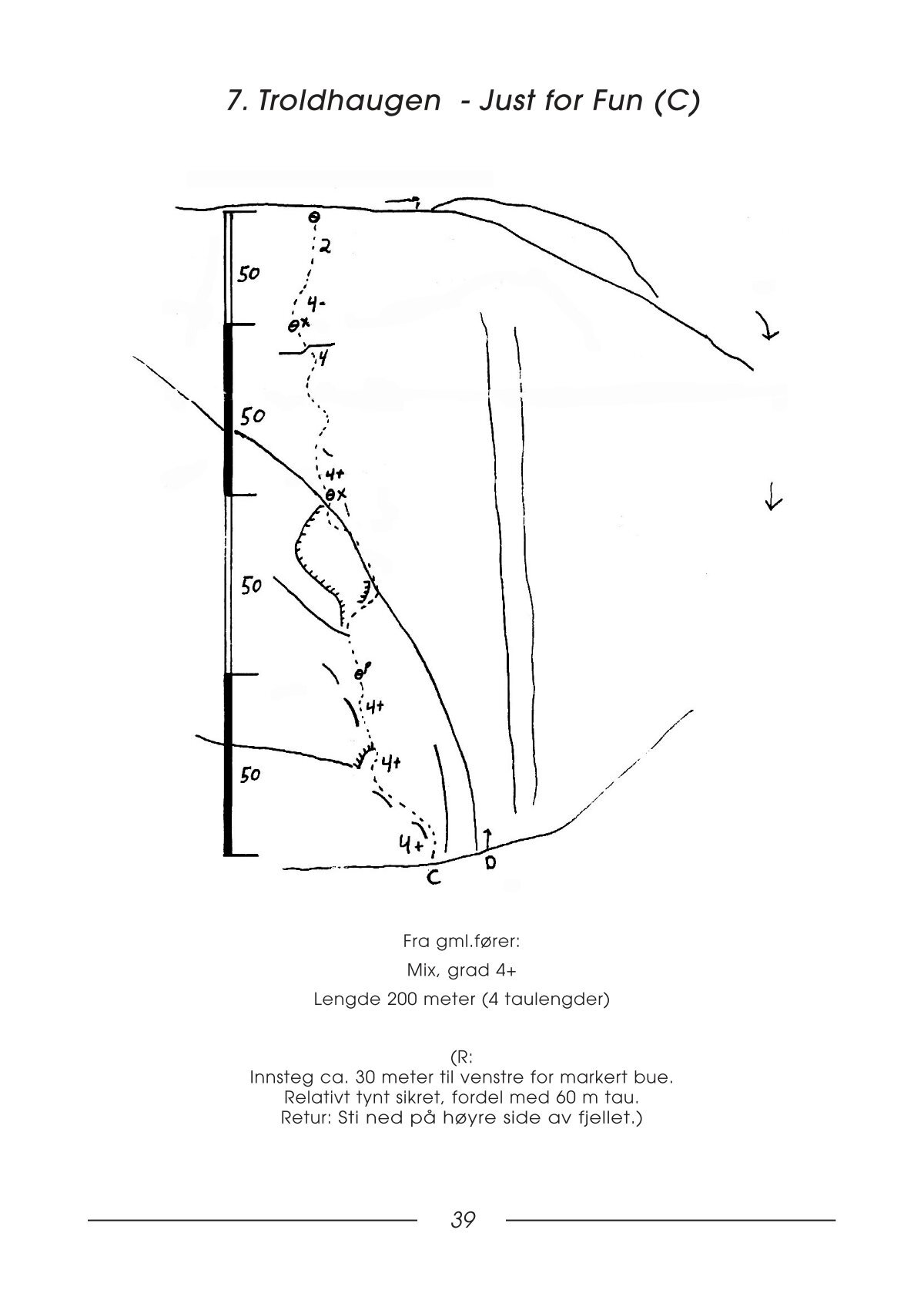
It is a 4+ mixed climbing route on Troldhaugen of about 200 meters (4 rope lengths) with bolted anchors.
GPS Coordinates
Elevation: 404 m
Latitude: 58.978512 N
Longitude: 8.357576 E
Parking
There is no dedicated parking spot available, however, there is a gravel road that leads to a campsite. One can park at the entrance of the gravel road or further down, closer to the campsite or at the end of the road.
Elevation: 282 m
Latitude: 58.977090 N
Longitude: 8.343916 E
Approach
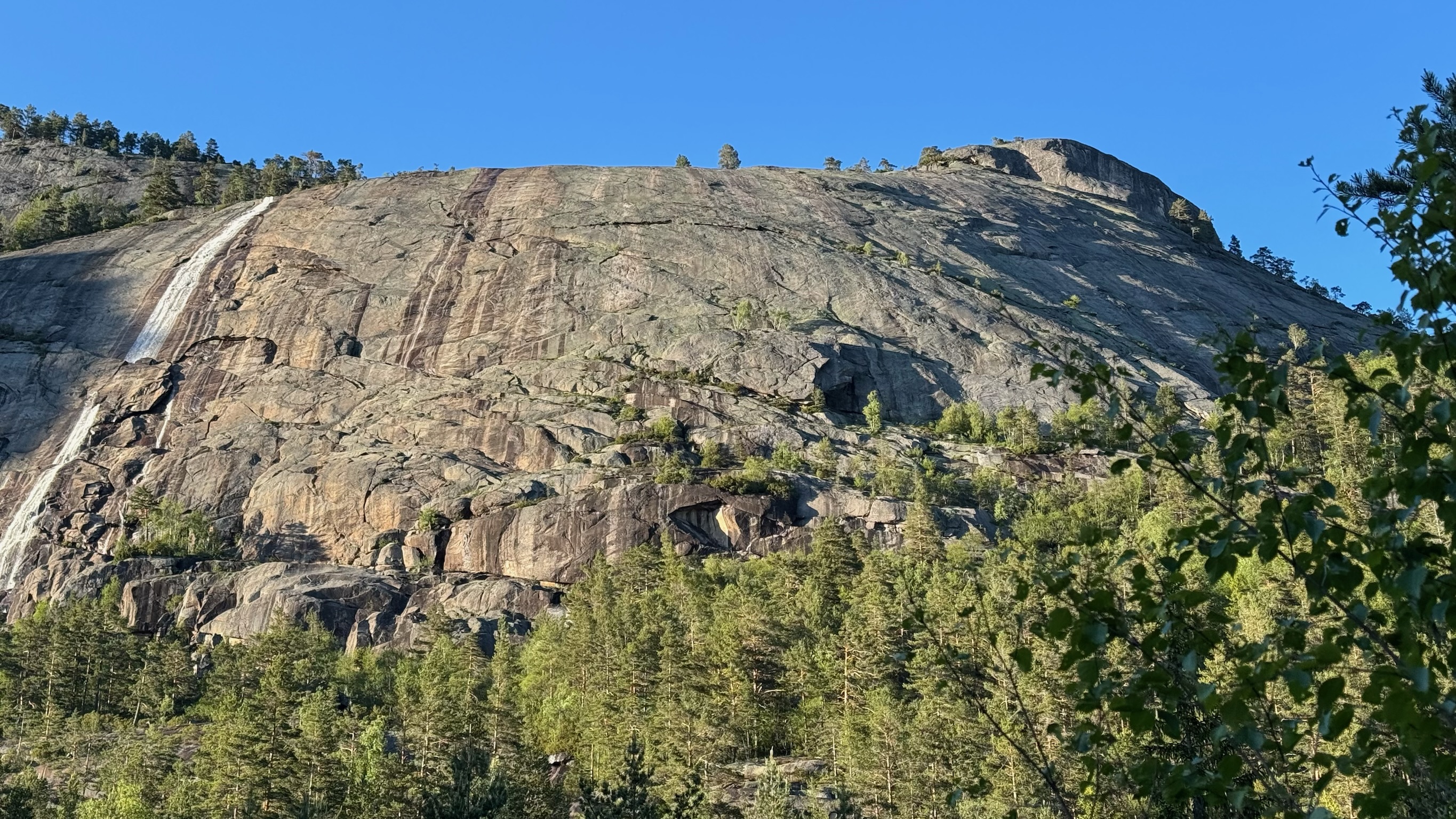
There is no clear path to follow and some path finding is required. The approach starts by following the gravel road till its end. Then one has to cross a small river, winding down towards the Dåstjønn lake. There is an old path indicated with orange dots on rocks, which will lead up towards Troldhaugen. In general, the dots, once found, are easy enough to follow, albeit it being in places hard to spot the next one. They follow a path up where boulders (and probably water) have come down the mountain. Therefore it is advisable to try and find this "boulder stream".
Starting point
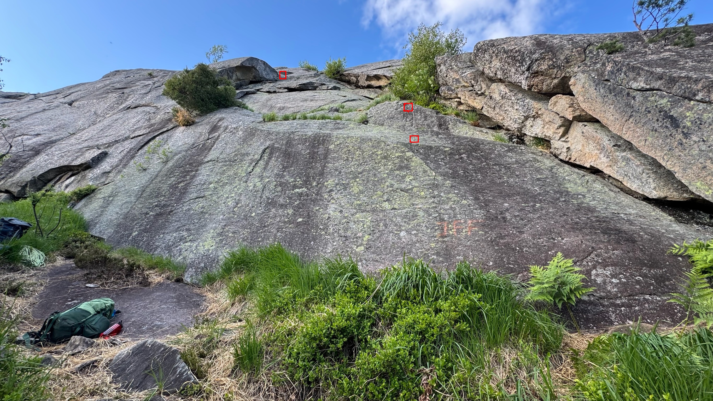
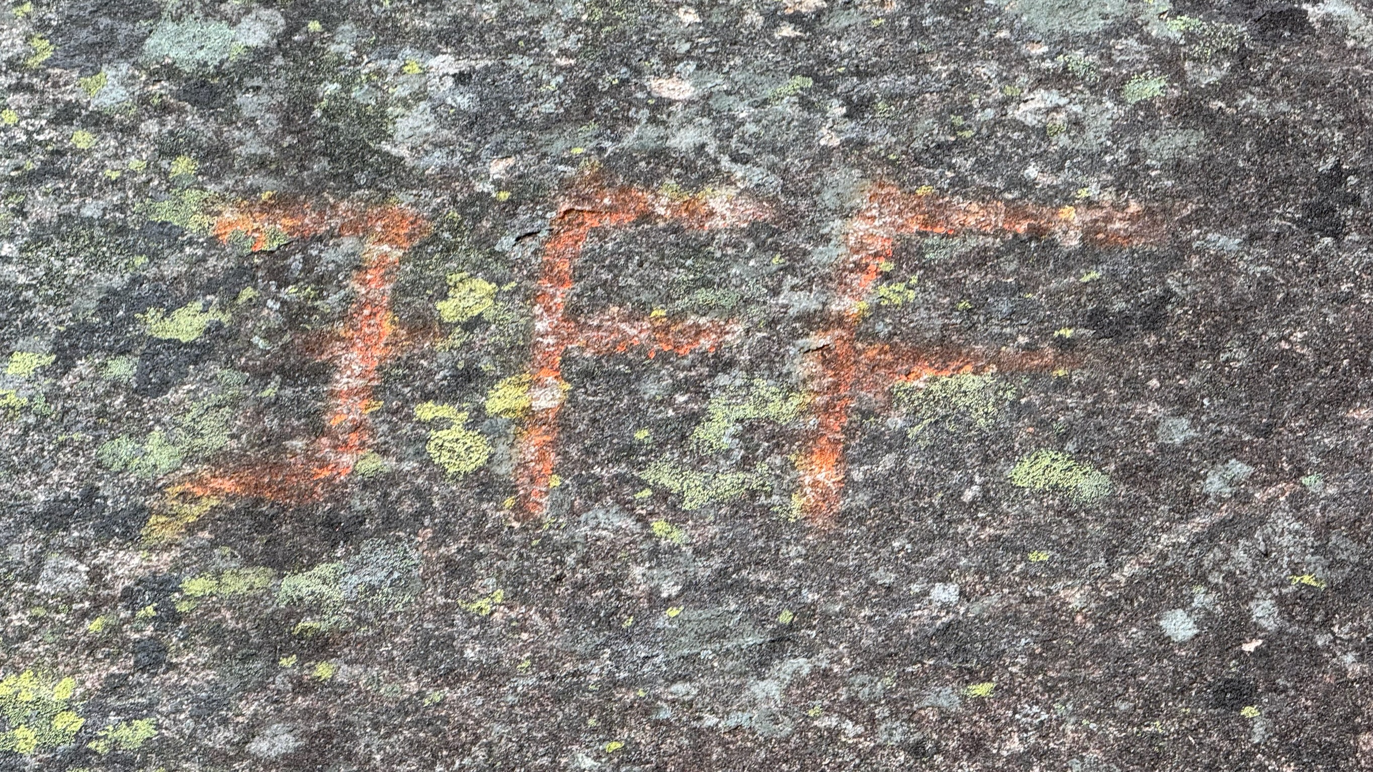
The starting point of the route is marked with big orange letters "JFF", hard to find the starting spot, but also hard to miss once you found the spot. In the image below, the first three bolts are marked to give an idea which way the route goes.
Topo
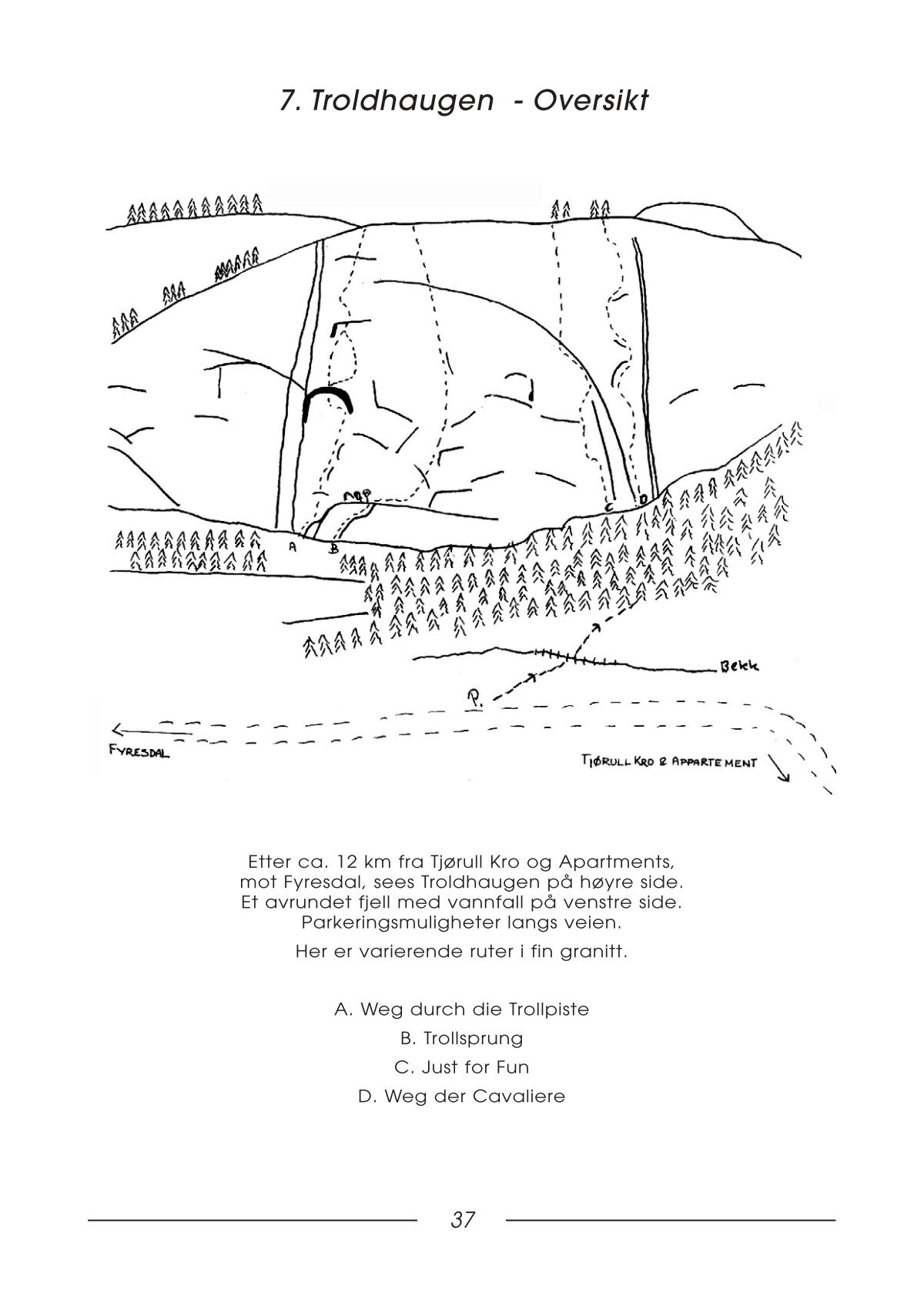
Topos taken over from the old guide book.
Descent
There should be a path around the back of Troldhaugen, leading back towards teh start. However, if that path is as good as the approach, it will be a tricky one to follow. Luckily the anchor points were bolted and so we could rappel down.
References
- Troldhaugen on 27Crags.com
- Troldhaugen on TheCrag.com
- Climbing notes we used for climbing, written by Hans Bräuner-Osborne
- Climbing notes we used for climbing, written by Tore Langhelle
- Dåstjønn lake on Google Maps
- Old guide book for Nissedal - Overview Troldhaugen - page 37
- Old guide book for Nissedal - Just for Fun topo - page 39